Victorian Resources Online (archived)
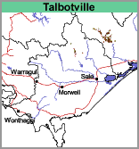
Talbotville (Te)
 |
Geology
This map unit occurs on the extensive Palaeozoic sediments throughout the Eastern Victorian Uplands. Geology includes shales, siltstones, sandstones, occasionally metamorphosed.
Landform
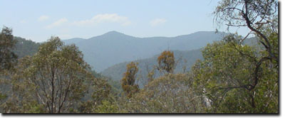
The mountainous terrain ridge and ravine topography has long steep slopes and rock
outcrops are abundant.
Landuse
Mostly uncleared. There is insufficient land which is cleared to make comments on land management issues.
Previous Maps and Reports
One soil profile (profile No. 11) - (PDF 90KB) was examined by Aldrick et al. (1992). Bedrock (decomposing siltstone and shale) was encountered 22 cm from the surface and about 30% of the soil was comprised of rock fragments up to 20 mm in diameter. The surface soil was a dark brown gravely clay loam overlying a strong brown gravely clay loam with increasing quantities of rock fragments. The pH was about 5.0 throughout. The soils were non-sodic.
Depth (cm) | pH | CEC (meq/100g) | Sodicity (ESP) |
0-5 | 4.8 – very strongly acid | 31.4 – high | 1 - non-sodic |
5-10 | 5.0 – very strongly acid | 21.6 – moderate | 1 - non-sodic |
10-20 | 5.0 - very strongly acid | 22.1 – moderate | 1 - non-sodic |
Soils
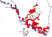 | The red shading shows the extent of the Talbotville map unit (Sargeant and Sargant, 2005). |
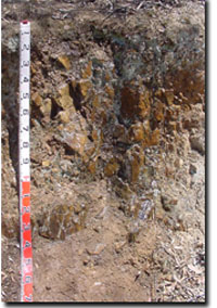
Talbotville Map Unit profile