Victorian Resources Online (archived)
Woolamai (Wm)
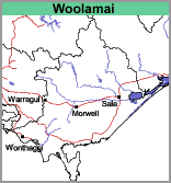 | Geology Devonian granites and Recent aeolian sediments. This map unit is restricted to Cape Woolamai on the south-east of Phillip Island. The Cape slopes upwards from an unstable dune system connecting it to the rest of the Island and ends abruptly with steep cliffs to seaward. Landform Rolling low hills. |
Soils
Although the underlying rock is granite, there is a mantle of blown sand rather than a soil profile developed in situ. The soils are deep sands, with the surface colours ranging from dark reddish grey-brown to dark grey. The subsoil is variably coloured, with light grey, red-brown and yellow-brown colours being usual.
Land Use
The area is a State Faunal Reserve. Mutton birds nest in great numbers on the Cape where they find the sand easy digging for their nesting burrows. The vegetation comprises of low coastal shrubs such as tea tree and heath, as well as rushes, sedges and tussocks.