Victorian Resources Online (archived)
Tinamba with Denison (Ti/De)
|
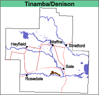
This map unit comprises mainly Tinamba with less than 30% of the Denison map unit. It occurs south of Fulham, adjoining the La Trobe River. |
 |
It is likely that this map unit was predominantly grassland (Lunt, 1997), with only about 5% of the area timbered.
Previous Maps and Reports
This mapping unit was included under the Sale land system by Aldrick et al (1992).
Soils
See Tinamba and Denison map units.
Land Use
The land is mostly used for annual or irrigated pastures.