Victorian Resources Online (archived)
Wandocka with Nuntin (Wa/Nt)
|
This map unit comprises mainly Wandocka with less than 30% of the Nuntin map unit. A small area occurs south of Clydebank. | 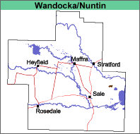 |
Unknown, probably grassland.
Previous Maps and Reports
This mapping unit was included under the Clydebank land system by Aldrick et al (1992).
Soils
See Wandocka and Nuntin map units.
Land Use
The land is mostly used for annual or irrigated pastures. Salinity can be a major problem.
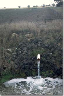 Ground water pumping in the Wandocka unit west of Lake Wellington. Note the east-west dune (Nuntin mapping unit) in background. |