Victorian Resources Online (archived)
Wellington (We)
|
Geology | 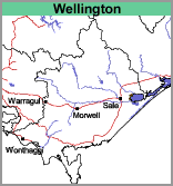 | 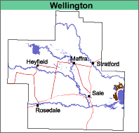 |
Previous Maps and Reports
Aldrick et al. (1992) included the soils of this map unit with the Clydebank and Nuntin Land Systems (dominantly sandy soils). In the present report, they are regarded as alluvial soils. Ward (1977) included them with the Roseneath and Reeve soil associations.
Soils
The soils in this mapping unit have not been well examined. The surface soils are mostly shallow dark brownish grey clay loams or light clays (occasionally medium clays) about 15 cm deep, overlying mottled brownish grey and yellowish brown medium to heavy clays. Sandy clays may appear before 1 m. These soils would possibly be classified as Sodic, Yellow or Brown Dermosols using the Australian Soil Classification.
Chemical and Physical Analysis
No analyses have been carried out on any of these soils.
Land Use
As the soils of this map unit are heavy textured and inclined to be saline, they are not irrigated and are used for grazing.