Victorian Resources Online (archived)
GRES395
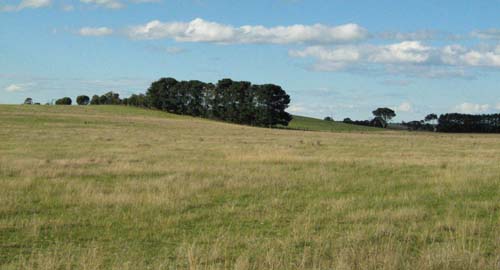
Location: Providence Ponds
Australian Soil Classification: Melacic, Humosesquic, Aeric PODOSOL
Map Unit: Perry
Previous Site Name: AL73
General Landscape Description: .Dunefield
Site description: 3% slope
Land Use: Unused
Native Vegetation: Heathy woodland
Geology: Aeolian sand
 Road exposure near the profile described below |
Soil Profile Morphology:
Surface Soil
| A1 | 0 – 22 cm | Very dark grey (10YR3/1); sand; single grain; soft consistence, dry; abrupt wavy change to: | |
| A2 | 22 – 75 cm | Greyish brown (10YR5/2); sand; single grain; loose dry; clear wavy change to: | |
| Subsoil | |||
| B2ir | 75 – 110 cm | Yellowish brown (10YR5/8); sand; single grain; loose dry; gradual change to: | |
| B3 | 110 – 150 cm | Brownish yellow (10YR6/6); loamy sand; single grain; soft dry; clear change to: | |
| 2B2ir | 150 – 297 cm | Brownish yellow (10YR6/6); loamy sand; single grain; 20 % ferruginous nodules up to 20 mm, increasing up to 40 mm. | |
Key Profile Features:
- Sand textures throughout the profile.
- Presence of iron/organic matter nodules at depth.
Chemical and Physical Analysis:
Horizon | Horizon Depth (cm) | pH (water) | EC dS/m | Exch. Acidity meq/100g | Exchangeable Cations | |||
Ca | Mg | K | Na | |||||
meq/100g | ||||||||
A1 | 0-10 | 5.2 | 0.02 | 3.6 | 1.4 | 0.05 | 0.1 | 0.1 |
A2 | 22-30 | 4.6 | <0.01 | 1.4 | 0.3 | 0.1 | 0.05 | 0.03 |
A2 | 60-75 | 4.9 | <0.01 | 0.2 | 0.2 | 0.01 | 0.02 | 0.09 |
B2ir | 75-90 | 5.1 | 0.01 | 3.2 | 0.3 | 0.01 | 0.06 | 0.04 |
B3 | 110-120 | 5.7 | <0.01 | 2.3 | 0.3 | 0.01 | 0.4 | 0.03 |
Horizon | Horizon Depth (cm) | Oxidisable Organic Carbon % | Total Nitrogen % | Free Fe2O3 % w/w | Coarse Sand (0.2-2.0 mm) % | Fine Sand (0.02-0.2 mm) % | Silt (0.002-0.02 mm) % | Clay (<0.002 mm) % |
A1 | 0-10 | 1.02 | 0.05 | 0.2 | 36 | 58 | 3 | 4 |
A2 | 22-30 | 0.25 | 0.02 | 0.1 | 37 | 61 | 1 | 1 |
A2 | 60-75 | 0.07 | 0.01 | 0.2 | 36 | 62 | 1 | 1 |
B2ir | 75-90 | 0.23 | 0.01 | 0.6 | 29 | 66 | 2 | 3 |
B3 | 110-120 | 0.3 | 30 | 68 | <1 | 2 |
Management Considerations:
Whole Profile
- Plant available water capacity (PAWC) would be very low but can be increased by additional organic matter.
- A major advantage of these soils is they usually drain very well and can be worked throughout the year.
- Sandy soils are extremely prone to wind erosion following vegetation removal.
Surface (A) Horizons
- As the soils are sandy and would have a low wilting point, plants will be able to utilise light rains falling on dry soil. However, due to the low water storage capacity, plants will soon suffer moisture stress unless further rainfall occurs. Organic matter is important in these sandy soils to enhance both water and nutrient holding capacity.
- The soil is strongly acid and a response to lime would be expected. Test strips should be used to evaluate the likely cost/benefit analysis. Benefits of liming include increased molybdenum availability, but it may make trace elements such as boron, zinc and manganese less available. Foliar analysis is advised where trace element deficiencies are suspected.
- The sandy surface soil will be prone to wind erosion if plant cover is removed and blow-outs can occur.
- The surface soil has an extremely low inherent fertility (based on the sum of the exchangeable cations). Such strongly leached soils are also likely to be naturally deficient in nitrogen, phosphorus, sulphur and potassium.
- The surface soil is extremely deficient in potassium and a response to potassium fertiliser would be expected.
- Regular fertiliser inputs are required for intensive cropping. Nitrate and sulphate are readily soluble and easily removed by leaching. More regular but smaller applications of fertiliser will assist in reducing loss of nutrients through leaching. Nutrients lost through leaching may influence catchment water quality.
Subsoil (B) Horizons
- The ‘coffee rock’ layer may restrict the downward movement of plant roots and water. In some situations, the temporary build up of water on top of this less permeable layer may be beneficial for deeper rooted plants as it prevents deep drainage of water away from plant roots.
Profile Described By: Aldrick et al 1992