Victorian Resources Online (archived)
Eroded Plain
Map symbol: EP
The four representative units of this landscape occur in the Dooen to Longerenong area. Landforms are level to gently undulating plains. The characteristic soil types include Drung sandy clay loam, Longerenong clay and Kalkee clay. The vegetation was probably Buloke. The accompanying landscape photograph was taken near the junction of the Henty and Wimmera Highways.
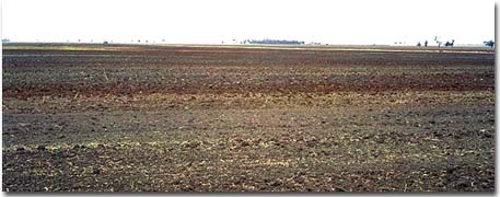
This photograph shows the variable soil types within this complex unit. At a depth of one metre, Tertiary period sandstone material was encountered in this area.