Victorian Resources Online (archived)
Eroded Slope
Map symbol: ES
The two representative map units of this landscape occur south of the Wimmera highway near the Yarriambiack Creek. Landforms are gently to moderately sloping plains. Characteristic soil types include Drung sandy clay loam, Longeranong clay and Kalkee clay. Vegetation was probably Buloke.
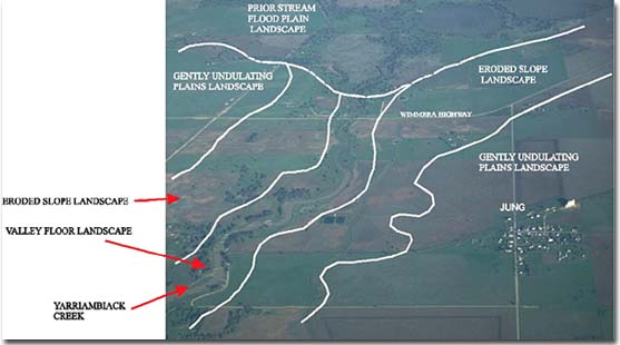
Eroded Slope landscape unit adjoining the Valley Floor landscape unit (Yarriambiack Creek) near Jung.