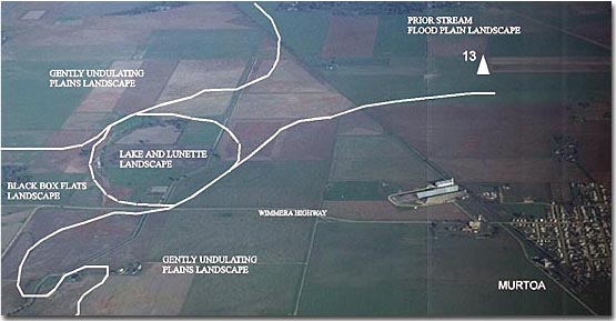
Lake and Lunette
Map symbol: LS and LC
There are five occurrences of lake and lunette single unit landscapes in the area. Part of a "clustered" unit occurs about 9 km north east of Murtoa. The description below refers only to single unit landscapes.
The soil types Bungalally clay, Horsham clay and Murtoa clay occur on the lake beds. Drung sandy clay loam is the main soil type of the lunettes. Drung sandy clay loam and Drung sandy loam occur both on the crest and upper slopes of the large lunette near the flood plains landscape unit at Dock Lake. Kalkee clay and Drung sandy clay loam occur on the lower slopes of this lunette.
For each landscape unit the lake and lunette sequence results in a characteristic topography. The lake bed occupies the greater part of the area of each unit. Each lunette (a rise, crescent shaped in plan) has a steep slope on the western or lake side and a longer gentle slope on the eastern side. While Black Box is the dominant tree species of the lake beds, Buloke is the dominant species on the large lunette near Coromby. A grassland formation may have existed on the lunette near Dock Lake.