River Frontage
Map symbol: RF
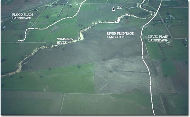
Units of the river frontage landscape unit border the Two Mile Creek east of Longerenong Agricultural College, the McKenzie River and the Wimmera River near Riverside, Horsham and Quantong. The landscape as a whole occupies a relatively small area. The flat to uneven ground surface is the lowest lying unit in the survey area. The lowest parts border the Wimmera River south and south east of Quantong. Some areas of native vegetation still remain in this landscape. Black Box is the dominant tree species and occurs singly and in fairly dense stands.
The characteristic soil type is Murtoa clay. Other soil types include Haven sandy loam, Haven sandy loam shallow phase, Quantong sand, Quantong sand shallow phase and Norton sandy clay. They occur mainly in the Quantong area where they occupy relatively small areas, often at different levels and separated by erosion gullies and stream courses.