Little Desert
Landscape
The landscape of the Little Desert unit is predominantly gently undulating plains, although there is a small area of higher relief that has been mapped as gently undulating rises. The unit is largely vegetated and a large area is part of the Little Desert National Park. Some areas have been cleared for agriculture.
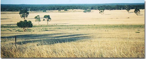 Cleared agricultural land of the Little Desert land system leading to the Little Desert National Park. |
Vegetation
The vegetation mainly consists of Mallee Eucalypts, Banksia, Tea Tree and heath understorey.
Soil Types
The dunes and rises commonly have over 1.5 metres of sand (Site WW20). Some of the lower slopes can reach the Parilla Sandstone base within one metre. On the depressions between the dunes there can be more clay formation under a shallower cover of sand.
Current Land Use
The land that is not part of the Little Desert National Park is used predominantly for grazing.