Victorian Resources Online (archived)
WLRA54
|
| WLRA54 | 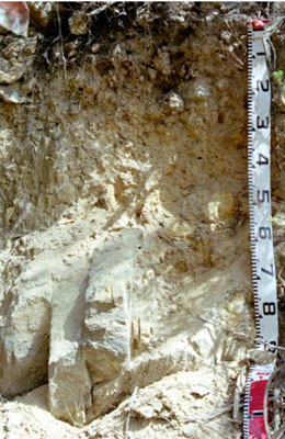 Basic, Lithic Bleached-Leptic, Tenosol | |
|
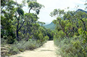
Location | Mount Stapylton, western Victoria | |||
|
Landform | Mountains | |||
|
Geology | Silurian-Devonian Grampians Group: quartz sandstone and red siltstone | |||
|
Element | Hillslope | |||
|
Slope | 50% | |||
|
Aspect | North | |||
Horizon | Depth (cm) | Description | ||
A11 | 0–5 | Light brownish grey (10YR 5/2); loamy sand;) to weak medium polyhedral structure parting to single grain (structureless); very weak consistence, pH 5.5; clear boundary to: | ||
A12 | 5–15 | Brownish yellow (10YR 5/3); loamy sand; weak polyhedral structure; weak consistence; pH 6.0; clear boundary to: | ||
A2 | 15–30 | Yellow (10YR6/4); silty loam; moderate medium polyhedral structure; rough ped-fabric; firm consistence; pH 6.0; gradual boundary to: | ||
B2 | 30–60/70 | Brownish yellow (10YR 6/6); sand; angular blocky parting to single grain (structureless); loose consistence. | ||
B2 | 60/70–70 | Brownish yellow (10YR 6/6); loamy sand; angular blocky parting to single grain (structureless); loose consistence; abundant sandstone. | ||
C | 70+ | Weathering sandstone. | ||
| Management considerations | ||||
| ||||