Victorian Resources Online (archived)
LSWW24
|
| LSWW24 | 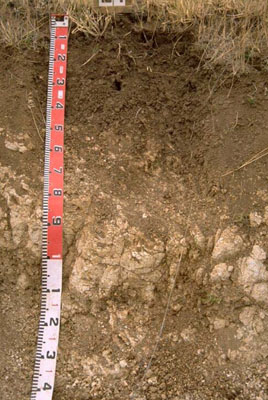 | |
|
Location | Karnak, western Victoria | |||
|
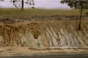
Landform | Rise | |||
|
Geology | Pleistocene Bridgewater Formation: calcareous sand and calcarenite beach ridges | |||
|
Element | Plain | |||
Horizon | Depth (cm) | Description | ||
A1 | 0–10 | Dark brown (7.5YR3/3) with few faint red mottles; light clay; strong medium subangular and polyhedral, parting to fine and very fine subangular and polyhedral structure; weak consistence when dry; pH 8.5: | ||
B2 | 10–40 | Brown (7.5YR4/3) with common faint red mottles; medium heavy clay; strong very fine polyhedral structure; firm consistence; a few soft and hard calcareous nodules; pH 8.5: | ||
C | 40+ | Limestone. | ||
| Management considerations | ||||
| ||||
Horizon | Depth (cm) | pH (water) | pH (CaCl2) | EC dS/m | Exchangeable Cations cmol-/kg | Wilting Point (pF4.2) | Coarse Sand % | Fine Sand % | Silt % | Clay % | |||
Ca | Mg | K | Na | ||||||||||
A1 | 0–10 | 8.5 | 7.8 | 0.11 | 14 | 4 | 1.2 | 0.2 | 15.7 | 27 | 24.6 | 6 | 34.5 |
B2 | 10–40 | 8.5 | 7.7 | 0.11 | 23 | 11 | 2.4 | 0.9 | 26.3 | 15.2 | 12.5 | 6.5 | 56.5 |
C | 40+ | ||||||||||||