Victorian Resources Online (archived)
LSWW28
| 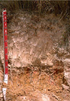 Yellow SODOSOL | |||
|
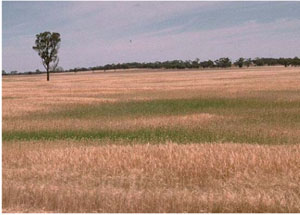
Location | Telopea Downs, western Victoria | |||
|
Landform | Dune | |||
|
Geology | Quaternary Lowan Formation: aeolian fine to medium grained dune sand | |||
|
Element | Duneslope | |||
Horizon | Depth (cm) | Description | ||
A11 | 0–15 | Grey (10YR5/1); sand; single grain (structureless); pH 6.6: | ||
A12 | 15–35 | Light brownish grey (10YR6/2); sand; single grain (structureless); pH 7.2: | ||
A13 | 35–80 | Light yellowish brown (10YR6/4); sand; single grain (structureless); pH 8.2: | ||
B2 | 80–90 | Light yellowish brown (10YR6/4) with reddish yellow and red mottles; sandy clay; clay tends to occur as clay skins in pockets such as root channels; pH 8.1: | ||
C | 90–120+ | Weathered sandstone. | ||
| Management Considerations | ||||
| ||||
Horizon | Depth (cm) | pH (water) | pH (CaCl2) | EC dS/m |
A11 | 0–15 | 6.6 | 5.9 | <0.05 |
A12 | 15–35 | 7.2 | 6.4 | <0.05 |
A13 | 35–80 | 8.2 | 7.3 | <0.05 |
B2 | 80–90 | 8.1 | 7.1 | 0.12 |
C | 90–120+ |