Victorian Resources Online (archived)
NA174
| ||||
|
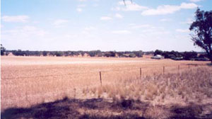
Location | Gymbowen, western Victoria | |||
|
Landform | Gently Undulating Plain | |||
|
Geology | Pliocene Parilla Sand: marine sand and silt | |||
|
Element | Hillcrest | |||
Description | ||||
Horizon | Depth (cm) | |||
A1 | 0–10 | Dark yellowish brown (10YR3/4); sandy loam; weakly structured; weak consistence, dry; pH 6.0; sharp boundary to: | ||
A2 | 10–30 | Yellowish red (5YR4/4); sporadically bleached (5YR7/3d); sandy loam; weak consistence, dry; pH 6.3; sharp boundary to: | ||
B2 | 30–80+ | Yellowish red (5YR5/8); medium clay; very strong consistence, slightly moist; pH 7.4. | ||
| Management considerations | ||||
| ||||
Horizon | Depth (cm) | pH (water) | pH (CaCl2) | EC dS/m | Exchangeable Cations cmol-/kg | Field Capacity (pF2.5) | Wilting Point (pF4.2) | |||
Ca | Mg | K | Na | |||||||
A1 | 0–10 | 6.0 | 5.0 | 0.10 | 3.9 | 1.1 | 0.5 | 0.1 | 11.2 | 6.5 |
A2 | 10–30 | 6.3 | 5.2 | 0.02 | 2.5 | 0.7 | 0.2 | 0.0 | 8.6 | 4.1 |
B21 | 30–80+ | 7.4 | 6.2 | 0.13 | 4.9 | 5.5 | 0.3 | 2.7 | 26.2 | 18.7 |