Victorian Resources Online (archived)
4.2.2 Plains without leveed channels (Wimmera River - Drung)
|
The Wimmera River from Greens Creek to Natimuk (defined as the Drung alluvial plains) are characterised by backplains with flats, slopes and stream channels while the modern drainage system has prominent stream banks, channels and drainage lines. In the Horsham area these plains were referred to as representative examples of the floodplain landscape (now referred to as the Drung map unit) and occur mostly south of the Wimmera River. In the east Wimmera Survey (Badawy 1984) soils of the unit comprised the Wal Wal association. The plains receive flows from all tributaries of the upper Wimmera catchment area including Mount Cole Creek, Wimmera River, Mount William Creek and Concongella Creek. Orientated and running almost east-west for over 80 km, the plains are quite expansive (up to 5 km wide) and reflect once greater fluvial activity in the dissected western uplands. Gradients are very gentle to level with the areas prone to flooding in wet seasons. | 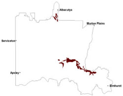 |
The absence of a developed channel network is reflected in the less complex distribution of soil types than that of the neighbouring prior stream plains. Grey Vertosols and red and brown Sodosols are the dominant soils. Important soil types include Horsham clay on the relatively level areas, Murtoa clay which often occurs at slightly lower levels and in local slight depressions, and Drung sandy clay loam which generally occurs on crests and on the upper slopes of slight rises. Each lake and lunette unit (referred to as the Kingcourt map unit) has a unique set of soil types. Bungalally clay (grey Vertosol) occupies the lake beds. Drung sandy clay loam occupies the lunettes. Soil complexes also occur on the lunette of the larger unit.
Woodlands are the dominant vegetation type, including communities such as Riverine Chenopod Woodland, Plains Grassy Woodland, Sand Ridge Woodland and Shallow Sands Woodland. Wetlands also occur and are found in creeklines and swampy areas. Land use on these alluvial plains include dryland cropping, pasture production (including lucerne), residential development and recreational activities especially around Horsham. In the Drung soil-landform unit, very little of the original native vegetation remains. Grey box and yellow gum rarely occur. Buloke occurs singly and occasionally in small stands.
Occasional flooding covers a smaller proportion of the area than neigbouring floodplains. Crop losses over the plains from these events would be proportionally less than the prior stream plains. Soil types mimic those of the prior stream plains with the same limitations of their adverse physical and chemical properties also being relevant (e.g. hardsetting surfaces and high sodicity in deeper subsoil). The less complex distribution of diverse soil types may present less difficulty in treating soil structural problems (e.g. hardsetting soil surfaces).
Soil-landform unit | Unit description | Area (km2) |
| Barrabool sand plains | Sand plain | 32 |
| Drung alluvial plain | Alluvial floodplain | 349 |
| Horsham lake and lunettes | Lake and lunette | 2 |
| Riverside level plains | Level plain | 1 |
| Werrap lake-lunettes | Prior stream plains | 55 |
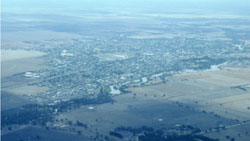
Figure 9 Wimmera River at Horsham