Victorian Resources Online (archived)
Soil - landform map units of the Dargo region
Back to: Soils and landforms of the Bairnsdale and Dargo Region
Soil-landform units of the Dargo region (PDF - 913KB) The high resolution PDF file provided on this page can be viewed using the free Adobe PDF reader and this software can be installed from the Adobe website (external link). This PDF is provided with a high level of detail and with the intent that it should be printed at a high resolution.
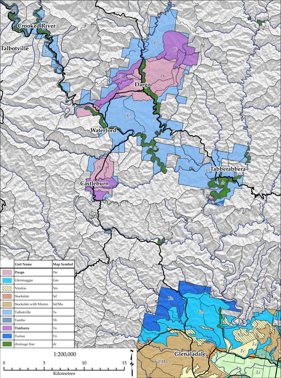
This is a clickable map. Click on land unit in legend for further information.
 |
|
Soil - landform units of the Dargo region
| Dargo (Do) | Glenmaggie (Gm) | Nindoo (Nn) | Stockdale (Sd) |
| Talbotville (Te) | Tambo (Tb) | Timbarra (Ta) | Turton (Tn) |
| Drainage line (dr) |