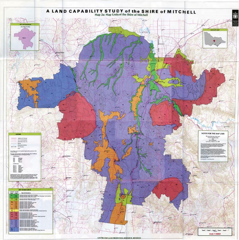
A Land Capability Study in the Shire of Mitchell map
Back to: A Land Capability Study in the Shire of Mitchell
The low resolution PDF file provided on this page can be viewed using the free Adobe PDF reader, this software can be installed for free from the Adobe website (external link).
A Land Capability Study in the Shire of Mitchell - Map 2a: Map Units of the Shire of Mitchell (PDF - 1634 KB)
The high resolution PDF file provided on this page can be viewed using the free Adobe PDF reader, this software can be installed for free from the Adobe website (external link).
This PDF is provided with a high level of detail and with the intent that it should be printed at a high resolution.
A Land Capability Study in the Shire of Mitchell - Map 2a: Map Units of the Shire of Mitchell (PDF - 29 MB)