Victorian Resources Online (archived)
Kerang Mapsheet - Soil Pit Sites
Back to: North Central Region Mapsheet Grid
Kerang Mapsheet - Soil Pit Sites (PDF - 254KB)
The high resolution PDF file provided on this page can be viewed using the free Adobe PDF reader and this software can be installed from the Adobe website (external link). This PDF is provided with a high level of detail and with the intent that it should be printed at a high resolution.
The Kerang mapsheet is clickable. Click on the respective soil pit for detailed information. The soil pits are also listed below and are clickable.
Note: Missing soil pits will be added as they become available.
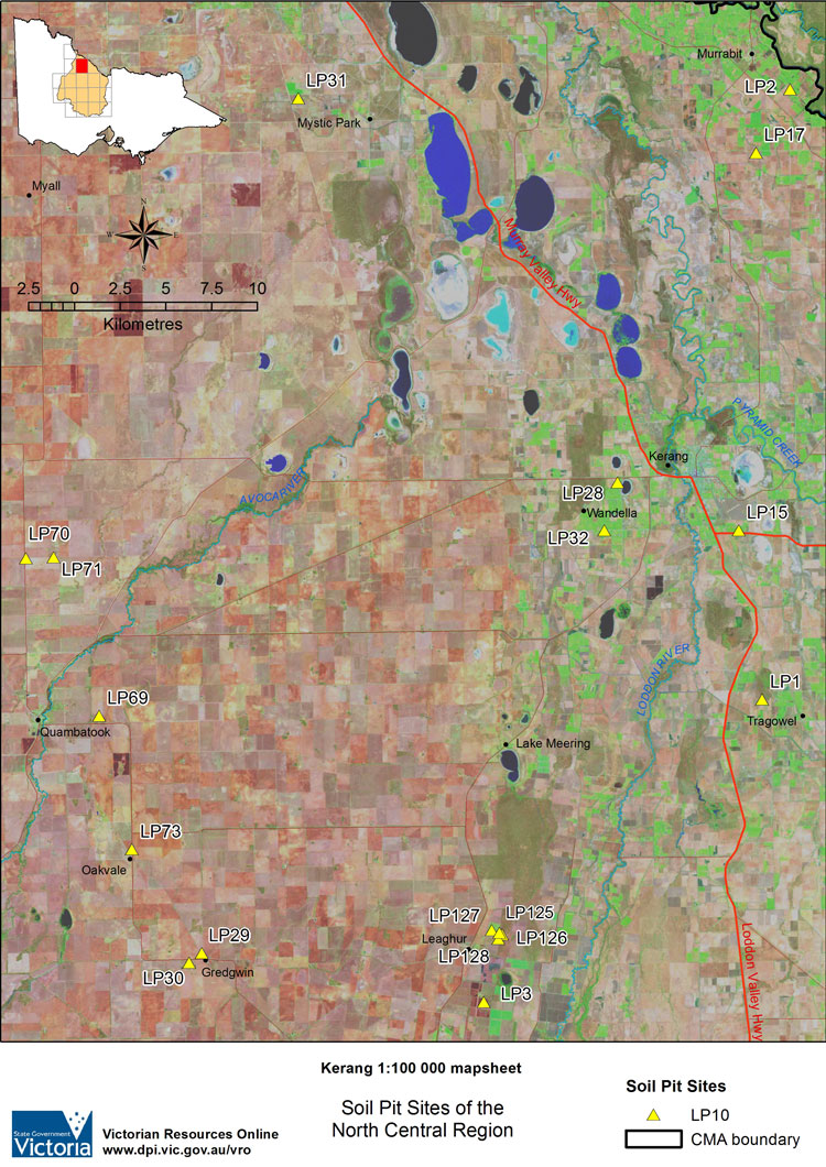
KERANG Mapsheet - Soil Pit Sites | ||||
| LP1 | LP2 | LP3 | LP15 | LP17 |
| LP28 | LP29 | LP30 | LP31 | LP32 |
| LP69 | LP70 | LP71 | LP73 | |
| LP125 | LP126 | LP127 | LP128 | |