Victorian Resources Online (archived)
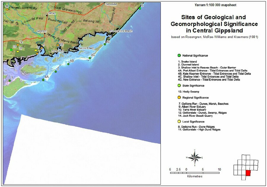
Sites of Geological and Geomorphological Significance - Yarram
Back to: West Gippsland Sites of Geological and Geomorphological Significance Map
This is a clickable map. Click on Site of Significance in Legend for detailed information.
| Sites of Geological and Geomorphological Significance - Yarram | ||
| National Significance | ||
| 1 Snake Island | 2 Clonmel Island | 3 Shallow Inlet to Reeves Beach - Outer Barrier |
| 4a Port Albert Entrance - Tidal Entrances and Tidal Delta | 4b Kate Kearney Entrance - Tidal Entrances and Tidal Delta | 4c Shallow Inlet - Tidal Entrance and Tidal Delta |
| 4d New Entrance - Tidal Entrances and Tidal Delta | ||
| State Significance | ||
| 13 Hedley Swamp | ||
| Regional Significance | ||
| 7 Gellions Run - Dunes, Marsh Beaches | 9 Albert River Estuary | 10 Tarra River Estuary |
| 12 Gelliondale - Dunes, Swamp, Ridges | 14 Jack River Basalt Quarry | |
| Local Significance | ||
| 8 Gellions Run - Dune Ridges | 11 Gelliondale - High Dune Ridges | |