Victorian Resources Online (archived)
Archived content — This page contains material from the Victorian Resources Online (VRO) website. It is no longer maintained and is provided for reference only. This content is hosted by CeRDI and is not endorsed by Agriculture Victoria.
Sitemap
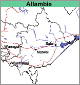
Allambie (Ab)
- Allambie and Warragul (Ab:Wg)
|
Geology
Early Tertiary sediments (commonly known as the Childers geological formation) which are older than the early Tertiary basalts. In the zone where basalts overlie these sediments, particularly on steep slopes, landslips are common (Brumley, 1983).
Landform
Rolling low hills. | |
Land Use
Mostly grazing, but where areas of this soil occurs within the
Warragul mapping unit vegetable cropping may also occur.
Soils
Variable, including gritty versions of
Warragul and
Silver Creek to gravel deposits of that epoch.
Allambie with Warragul (Ab/Wg)
This mapping unit describes areas, comprising mostly the Allambie mapping unit with some areas of the
Warragul mapping unit. The percentage of the dominant mapping unit is at least 70%.