Victorian Resources Online (archived)
Soil/Landform Mapping St Arnaud - St Arnaud Mapsheet
To view the information PDF requires the use of a PDF reader. This can be installed for free from the Adobe website (external link).
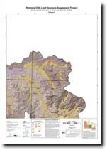 | Map of St Arnaud - (T7254) (Adobe 1.1 Mb) | Landform Units Map Unit descriptive names (Adobe pdf 109 Kb) |
| Soil/Landform Units | |||
| Ararat Hills | Concongella Hills | Drung Alluvial Plains | Elmhurst Footslopes |
| Glenorchy 1 | Glenorchy 2 | Howard Creek 1 | Howard Creek 2 |
| Howard Creek 3 | Joel South Hills | Kanya Hills | Landsborough 2 |
| Landsborough 3 | Langi Ghiran Ranges | Langi Slopes 2 | Navarre 1 |
| Navarre 2 | Navarre 3 | Pyrenees Mountains | Rhymney Hills |
| Six-Seven Mile Creeks | Sugarloaf Granitic Hills | Surridge 2 | Wattle Creek Covered Plain |
| Soil Groups | |
| 1 | 10 |
| Soil Pits | |
| LP 82 LP 83 DOAGW 32 | LP 80 DOAGW 2 DOAGW 17 |
| Geomorphic Units | ||||||
| 2.1.1 | 2.1.2 | 2.1.3 | 2.1.4 | 2.1.5 | 2.1.6 | 2.1.7 |
| 2.2.1 | 2.2.2 | 2.2.3 | 2.3.1 | 2.3.2 | 4.1.1 | 4.1.2 |
| 4.2.1 | 4.2.2 | 4.2.3 | 4.3 | 5.1.3 | 5.1.5 | 5.2.1 |
| 5.2.2 | 5.3.3 | 5.4 | 5.5.1 | 5.5.2 | 5.5.3 | 5.6 |
| 6.2.1 | ||||||