Victorian Resources Online (archived)
Archived content — This page contains material from the Victorian Resources Online (VRO) website. It is no longer maintained and is provided for reference only. This content is hosted by CeRDI and is not endorsed by Agriculture Victoria.

Sitemap

Warragul Soils

Back to: West Gippsland - Warragul Mapsheet

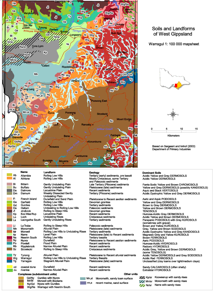
This is a clickable map. Click on Soil/Landform Unit for detailed information.

Warragul Soils

Warragul soils
Ab - AllambieAl - AthloneBi - BitternBu - Buffalo
Da - DalmoreDm - DarnumFi - French IslandGa - Garfield
Gd - GurdiesHa - HallamJi - JindivickKp - Koo Wee Rup
Lo - LochLs - Leongatha SouthLt - La TrobeMn - Monomeith
Mr - MorwellNr - NarreNs - Neerim SouthNy - Nyora
Po - PowlettRb -RipplebrookSz - StrzeleckiTy - Tynong
Wg - WarragulYg - Yarragoncd - coastal duneriv - riverine
Gd/Ny - Gurdies with NyoraMr/Bl - Morwell with boolarraNy/Gd - Nyora with GurdiesWg/Ns - Warragul with Neerim South
Mn, sl - Monomeith, sandy loam surfacerm, s - recent marine, sand surfaceKp/sr - Koo Wee Rup with sandy risesMn/sr - Monomeith with sandy rises
Nr/sr - Narre with sandy rises