Victorian Resources Online (archived)
Soil/Landform Mapping Rupanyup - Rupanyup Mapsheet
To view the information PDF requires the use of a PDF reader. This can be installed for free from the Adobe website (external link).
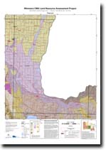 | Map of Rupanyup - (T7424) (PDF 1.3MB) | Landform Units Map Unit descriptive names (PDF 109KB) |
| Soil/Landform Units | |||
| Barrabool Sand Plains | Bellellen 1 | Bellellen 2 | Bellellen 3 |
| Concongella Hills | Donald Lakes & Lunettes | Dooen Eroded Plains | Drung Alluvial Plains |
| Glenorchy 1 | Glenorchy 2 | Grampians Outwash Slopes | Grampians Plains |
| Grampians Ranges | Grampians Storages | Great Western 2 | Great Western 3 |
| Horsham L&L | Howard Creek 1 | Howard Creek 2 | Joel South Hills |
| Jerro Eroded Ridges & Slopes | Kalkee Plains | Kalkee Plains 2 | Kanya Hills |
| Kellalac Ridge Crests | Longerenong Prior Stream Plains | Lubeck Alluvial Plains | Mt Cole Creek |
| Mt Dryden Metamorphic Hills | Mt William Creek | Murtoa Flats | Murra Warra East Gentle Rises |
| Navarre 1 | Six-Seven Mile Creeks | St Helens Gentle Plains | Wal Wal Prior Stream Plains |
| Wattle Creek Covered Plain | Yarriambiack/Dunmunkle Creek | ||
| Soil Groups | |
| 25 | 27 |
| Soil Pits | |
| WIA 14 WIA 16 WLRA 105 | Top Crop 1 Top Crop 2 LS 17 WIA 3 |
| Geomorphic Units | ||||||
| 2.1.1 | 2.1.2 | 2.1.3 | 2.1.4 | 2.1.5 | 2.1.6 | 2.1.7 |
| 2.2.1 | 2.2.2 | 2.2.3 | 2.3.1 | 2.3.2 | 4.1.1 | 4.1.2 |
| 4.2.1 | 4.2.2 | 4.2.3 | 4.3 | 5.1.3 | 5.1.5 | 5.2.1 |
| 5.2.2 | 5.3.3 | 5.4 | 5.5.1 | 5.5.2 | 5.5.3 | 5.6 |
| 6.2.1 | ||||||