
| Corangamite Soil Health Strategy 2006-2012 |
| Home | Introduction | CSHS Report | Background Reports | Outputs/Maps | Projects | Community/Events | Contacts | Links | Photo Gallery |
|
|
| Photo Gallery |
| Landslides |
| Erosion |
| Acid Sulfate Soils |
| Secondary Salinity |
| Field Days |
| Rehabilitation |
| Landslides | |||
|
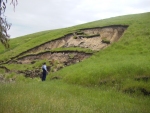
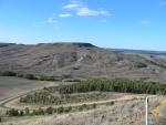
Rotational landslide - adjacent to a water main at Sheoaks in
November 2001. (Photograph: P. Dahlhaus 2001) [View larger image] |
|
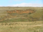
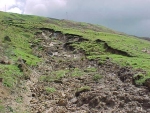
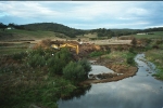
Rotational landslide and earth flow – from the headscarp of a
much larger landslide on the Barwon River at Birregurra. (Photograph: A. Miner 2006) [View larger image] |
|
|
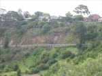
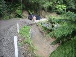
Earth flows – triggered by heavy rain on Deviation Road,
Fyansford in February 2005. (Photograph: A. Miner 2005) [View larger image] |
|
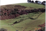
Earth flow – at Wongarra in the Otways in 1986. (Photograph: P. Dahlhaus 1991) [View larger image] |
|
|
Landslide complex – comprising numerous landslide types at Parwan
Valley. (Photograph: A. Miner 2006) [View larger image] |
|
Earth flow – on property above the Great Ocean Road,
triggered by heavy rainfall in October 2000. (Photograph: A. Miner 2000) [View larger image] |
|
|
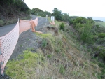
Shallow transitional landslide – failure on Turton's Track after
heavy rainfall in February 2005. (Photograph: A. Miner 2005) [View larger image] |
|
Shallow landslide – on road-fill embankment at Johanna. (Photograph: A. Miner 2006) [View larger image] |
|
|
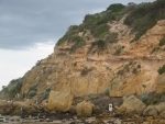
Rockfall – large intact fall at the Bluff, Barwon Heads in
October 2000. (Photograph: P. Dahlhaus 2000) [View larger image] |
|
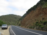
Landslide – old dormant landslide debris on the Great Ocean Road. (Photograph: A. Miner 2006) [View larger image] |
|
Top of Page |
|||
| Erosion | |||
|
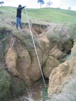
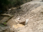
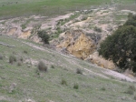
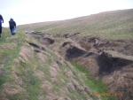
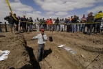
A gully erosion site being surveyed in preparation for a
rehabilitation plan. [View larger image] |
|
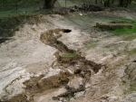
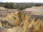
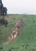
Gully erosion in its
early phase. [View larger image] |
|
|
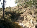
Erosion contributing sediment loads into a waterway. [View larger image] |
|
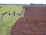
Soil loss as a result of sheet erosion on potato growing red
volcanic soils. [View larger image] |
|
|
A gully erosion site in the Leigh. (Photograph: R Cotterl) [View larger image] |
|
Gully erosion in the
Moorabool. (Photograph: R Cotterl) [View larger image] |
|
|
Erosion in Eclipse Creek, Moorabool. (Photograph: R Cotterl) [View larger image] |
|
Rill erosion starting to transform into gullies. [View larger image] |
|
|
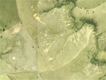
Aerial photograph of erosion at Illabarook - Woady Yaloak. [View larger image] |
|
Gully erosion in the
Moorabool. [View larger image] |
|
|
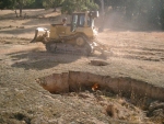
Tunnel erosion being broken down by a bulldozer in an attempt to
rehabilitate the site. [View larger image] |
|
Sheet and gully erosion. [View larger image] |
|
|
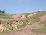
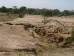
Sheet, rill and gully erosion in Misery Moonlight area - Woady
Yaloak. [View larger image] |
|
Gully erosion at
Rokewood - Woady Yaloak. [View larger image] |
|
|
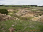
Gully erosion in the volcanic plains. [View larger image] |
|
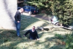
Tunnel erosion posing a risk to the foundations of a house. [View larger image] |
|
|
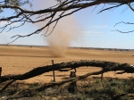
Wind erosion on a cropping paddock. [View larger image]
|
|
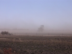
Wind erosion on
a fallowed paddock. [View larger image] |
|
Top of Page |
|||
| Acid Sulfate Soils | |||
|
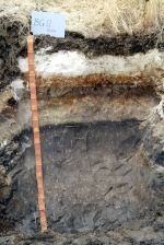
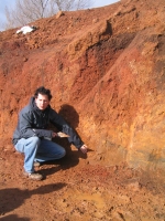
An acid sulfate soil profile. [View larger image] |
|
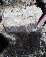
Soil characteristics of an acid
sulfate soil. [View larger image] |
|
|
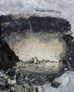
Soil characteristics of a potential acid sulfate soil. [View larger image] |
|
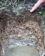
Soil properties of a potential acid sulfate soil. [View larger image] |
|
|
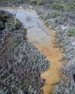
An estuary with potential acid sulfate soils if disturbed impacts could
occur. [View larger image] |
|
||
| Secondary Salinity | |||
|
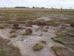
Secondary salinity at Wernett. [View larger image] |
|
||
Top of Page |
|||
| Field Days | |||
|
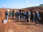
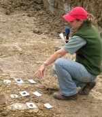
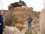
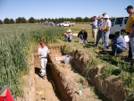
Troy Clarkson (DPI), explaining soil properties to a group of farmers
participating in a soil health training course. [View larger image] |
|
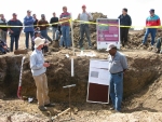
Troy Clarkson (DPI), explaining
a soil profile to a group at a field day. [View larger image] |
|
|
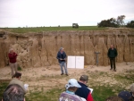
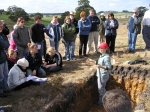
Shari Wallis (DPI), explaining the Emerson and pH test to a group of
farmers at a field day. [View larger image] |
|
Farmers gathered around for the 2005 Raised Bed Field Day. [View larger image] |
|
|
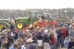
Farmers watching a machinery demonstration at the 2005 Raised Bed Field
Day. [View larger image] |
|
Troy Clarkson (DPI), explaining soil properties and management to farmers
at the 2004 Raised Bed Field Day. [View larger image] |
|
|
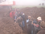
Greg Peters (CCMA), talking about erosion management to farmers in the
Woady Yaloak. [View larger image] |
|
Paul Whinney and Paul Regan (DPI), talking about pasture management on
highly erodable soils to farmers in the Woady Yaloak. [View larger image] |
|
|
Troy Clarkson (DPI), talking to farmers in the potato-growing area near
Ballarat, on soil health issues. [View larger image] |
|
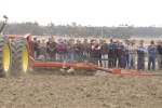
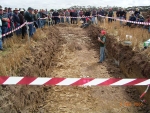
Shari Wallis (DPI), speaking to over 200 farmers on soil health issues at the 2005 Raised Bed Field
Day. [View larger image] |
|
|
Troy Clarkson (DPI), talking about soil health at the 2003 Streatham Field
Day. [View larger image] |
|
Troy Clarkson (DPI), discussing the importance of soil structure at the 2005 Raised Bed Field
Day. [View larger image] |
|
|
Shari Wallis (DPI), discussing soil health in the landscape at the Wurdale
Field Day. [View larger image] |
|
||
| Rehabilitation | |||
|
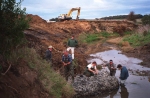
The Leigh community working together to rehabilitate streambank
erosion at Garibaldi Creek, a tributary of the Leigh River. [View larger image] |
|
Work in progress to stabilise
streambank erosion at Garibaldi Creek, a tributary of the Leigh River. [View larger image] |
|
Top of Page |
|||
|
|
| Corangamite CMA Home | Acknowledgement | Disclaimer |

|
|
Page Updated: November 2007 |