Victorian Resources Online (archived)
Archived content — This page contains material from the Victorian Resources Online (VRO) website. It is no longer maintained and is provided for reference only. This content is hosted by CeRDI and is not endorsed by Agriculture Victoria.
Sitemap
Sale Soils
Back to: West Gippsland - Sale Mapsheet
This is a clickable map. Click on Soil/Landform Unit for detailed information.
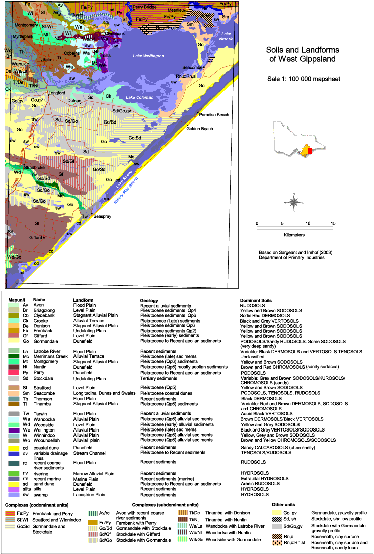
| Sale Soils |
| Av - Avon | Br - Briagalong | Cb - Clydebank | Ck - Crooke | De - Denison |
| Fe - Fernbank | Gf - Giffard | Go - Gormandale | La - Latrobe River | Mc - Merrimans Creek |
| Mt - Montgomery | Nt - Nuntin | Py - Perry | Sd - Stockdale | Sf - Stratford |
| Sm - Seacombe | Th - Thomson | Ti - Tinamba | Tw - Tarwin | Wa - Wandocka |
| Wd - Woodside | We - Wellington | Wi - Winnindoo | Wo - Wooundellah | cd - coastal dune |
| dv - variable drainage lines | rc - recent course river sediments | riv - riverine | rm - recent marine | sd - sand dune |
| silts - silts | sw - swamp | Fe:Py - Fernbank and Perry | Sf:Wi - Stratford and Winnindoo | Go:Sd - Gormandale and Stockdale |
| Av/rc - Avon with recent river sediments | Fa/Py - Fernbank with Perry | Go/Sd - Gormandale with Stockdale | Sd/Gf - Stockdale with Giffard | Sd/Go - Stockdale with Gormandale |
| Ti/De - Tinamba with Denison | Ti/Nt - Tinamba with Nuntin | Wa/La - Wandocka with Latrobe River | Wa/Nt - Wandocka with Nuntin | Wd/Go - Woodside with Gormandale |
| Go,gv - Gormandale, gravelly profile | Sd,sh - Stockdale, shallow profile | Sd/Go,gv - Stockdale with Gormandale, gravelly profile | Rn,c - Roseneath, clay surface | Rn,c:Rn,sl - Roseneath, clay surface and Roseneath, sandy loam |