Victorian Resources Online (archived)
Archived content — This page contains material from the Victorian Resources Online (VRO) website. It is no longer maintained and is provided for reference only. This content is hosted by CeRDI and is not endorsed by Agriculture Victoria.

Sitemap

Rutherglen Soils

Back to: North East - Rutherglen Research Intitute

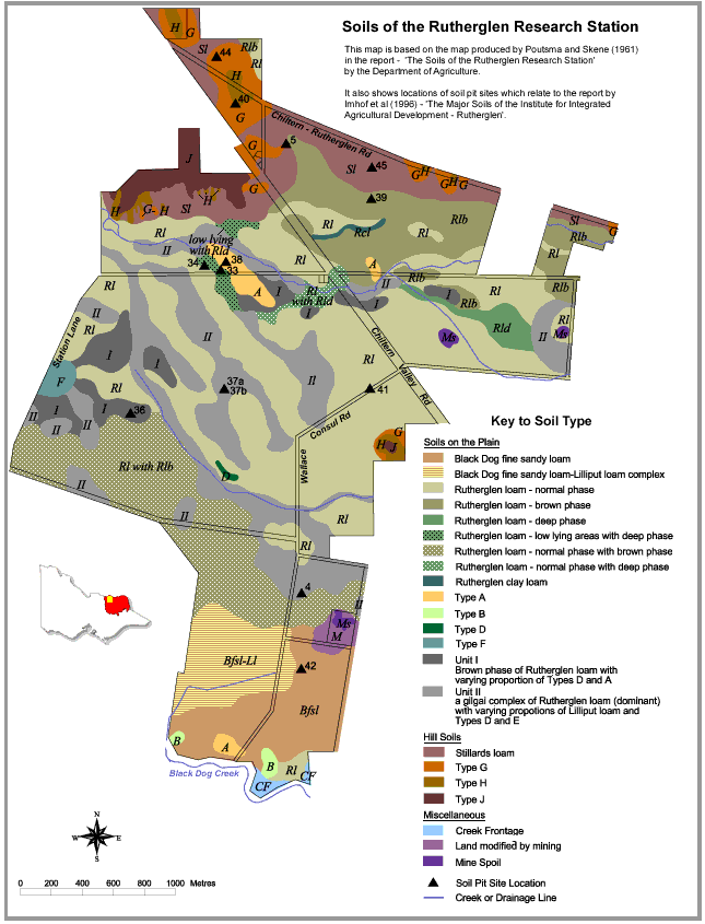
This is a clickable map. Click on Soil Type in Legend or Soil Pit on map for detailed information.

Rutherglen Soils

Rutherglen soils
Soils on the PlainsType AType HSoil PitsNE40
Black Dog fine sandy loamType BType JNE4NE41
Black Dog fine sandy loam - Lilliput loam complexType DNE5NE42
Rutherglen loam - normal phaseType FMiscellaneousNE33NE44
Rutherglen loam - brown phaseUnit 1Creek frontageNE34NE45
Rutherglen loam - deep phaseUnit 2Land modified by miningNE36
Rutherglen loam - low lying areas with deep phaseMine spoilNE37a
Rutherglen loam - normal phase with brown phaseHill SoilsNE37b
Rutherglen loam - normal phase with deep phaseStillards loamNE38
Rutherglen clay loamType GNE39