Victorian Resources Online (archived)
Wimmera Irrigation Soil/Landform Mapping
Back to: Wimmera - Landscape Units
This is a clickable map. Click on Landform description in Legend for detailed information
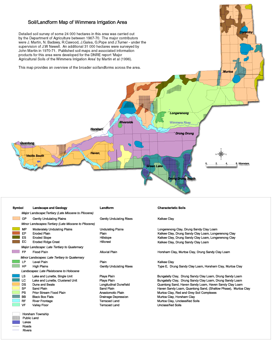
| Wimmera Irrigation Area Soil Mapping - Soil/Landform Mapping | |
| Major Landscape: Tertiary (Late Miocene to Pliocene) | Landscapes: Late Pleistocene to Holocene |
| GP - Gently undualting plains | LS - Lake and lunette - single unit |
| LC - Lake and lunette - clustered unit | |
| Minor Landscapes: Tertiary (Late Miocene to Pliocene) | DS - Dune and swale |
| MP - Moderately undulating plains | SP - Sand plain |
| EP - Eroded plain | PS - Prior stream flood plain |
| ES - Eroded slope | BB - Black box flats |
| EC - Eroded ridge crest | RF - River frontage |
| VF - Valley floor | |
| Major Landscape: Late Tertiary to Quaternary | |
| FP - Flood plain | |
| Minor Landscapes: Late Tertiary to Quaternary | |
| LP - Level plain | |
| HP - High plains | |