Victorian Resources Online (archived)
Port Phillip and Westernport Region Soil Pits
A number of soil pits have been characterised and described associated with various projects within the Department of Economic Development, Jobs, Transport and Resources and previous Departments.
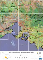 Port Phillip and Westernport Region Soil Pits - Mapsheet Grid | This is a clickable map of the Port Phillip and Westernport Region of Victoria. Click on this regional map to access the Port Phillip and Westernport mapsheet grid that highlights the soil pits characterised in this region. |
Port Phillip and Westernport Region Soil Pit Sites